November 2013 Weather and Its Impacts on Missouri
Pat Guinan
State Climatologist
Commercial Agriculture/University of Missouri Extension
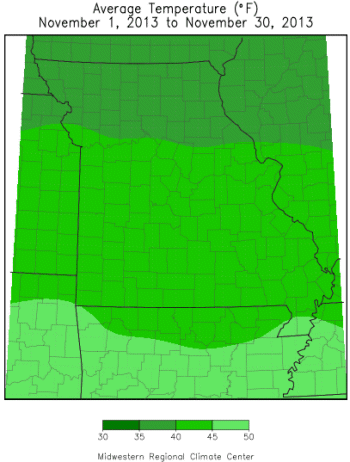
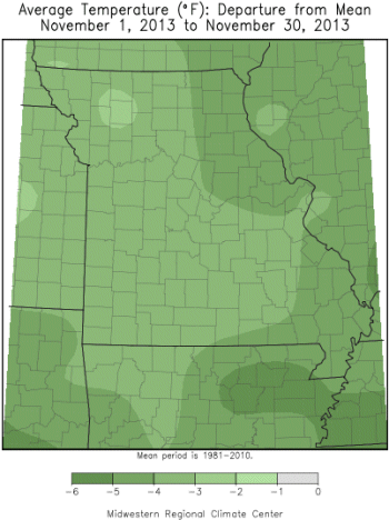
Cooler than normal temperatures dominated Missouri during November and continued the trend of below normal temperatures for the year. Only January, February and September have been warmer than normal in 2013, Figure 1. Preliminary data indicate an average November temperature of 41.5°F, or 2.7°F below the long-term average, and the coolest November since 2000, Figure 2. It was only the 4th November in the past 15 years to average below normal.
Mostly seasonable temperatures occurred during the first half of November with a brief warm-up thereafter. Many locations climbed into the 70's on the 16th or 17th, but a major weather pattern change quickly followed, and resulted in a cold, below normal period for the remainder of the month, Figure 3. Single digit temperatures impacted much of northern Missouri on the 23rd and 24th. The extended period of sub-freezing temperatures led to some thin ice formation on some of the smaller lakes and ponds, an unusual occurrence for November.
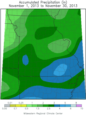
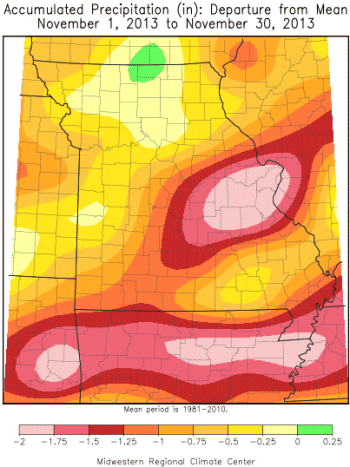
November precipitation was less than normal with preliminary data indicating a statewide average of 2.60 inches, or about a third of an inch below the long-term average. Lighter amounts, generally less than 2-inches, occurred over parts of northern and central Missouri. Northwestern and east central sections of the state received the least amount of precipitation.
Some of the lowest monthly totals were reported in Jefferson (1.32"), St. Louis (1.02"), Nodaway (0.96"), Atchison (0.84"), and Jackson (0.65") counties. Heavier amounts occurred over portions of far south central and southeastern Missouri, where many locations reported more than 3-inches. Highest totals, in excess of 5-inches, were observed in Reynolds (5.00"), Bollinger (5.02"), Wayne (5.11"), Butler (5.24") and Cape Girardeau (6.29") counties.
Missouri was on the western edge of a major tornado outbreak on November 17th, Figure 4. A strengthening storm system and strong cold front barreled through the state during the morning and early afternoon hours of the 17th and thunderstorms began developing over eastern Missouri during the mid-morning hours. Two tornadoes were documented in southeastern Missouri, in Scott and Perry counties. The Scott county event was classified as an EF-3 tornado with peak winds of 140 mph, 600 yards wide, and path length of 19 miles. Property damage was reported with 9 mobile homes and two stick built homes destroyed. The Perry county storm event was classified as an EF-0 tornado with peak winds of 70 mph. No injuries were reported with either tornado. A few days later, a wintry light mix of sleet, freezing rain and snow impacted parts of northwestern Missouri on November 21-22 and resulted in hazardous driving conditions.
Moderate drought was still impacting parts of northern and east central Missouri toward the end of November, Figure 5. Significant water deficits have accumulated since June 1 and more precipitation was needed to replenish soil profiles and surface water supplies, Figure 6.
As of November 24th, the Missouri Agricultural Statistics Service reported 53% of the pastures across northeastern Missouri in poor to very poor condition. The north central crop reporting district reported 45% of the pastures in poor to very poor condition. Despite these conditions, all crop reporting districts reported the majority of their hay supplies and other roughages as adequate. Stock water supplies remained mostly adequate statewide, though the northeast district reported 41% in short to very short supply. Winter wheat conditions were favorable across the state with 95% of the crop in fair to good condition.
Jump to:
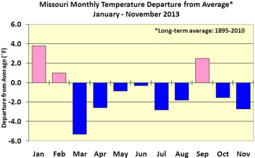
Figure 1
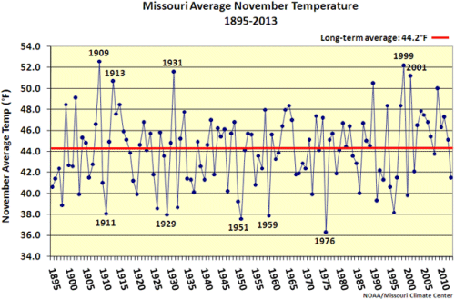
Figure 2
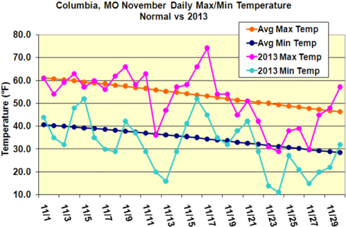
Figure 3
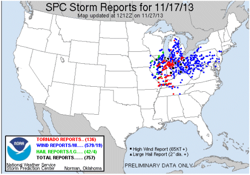
Figure 4
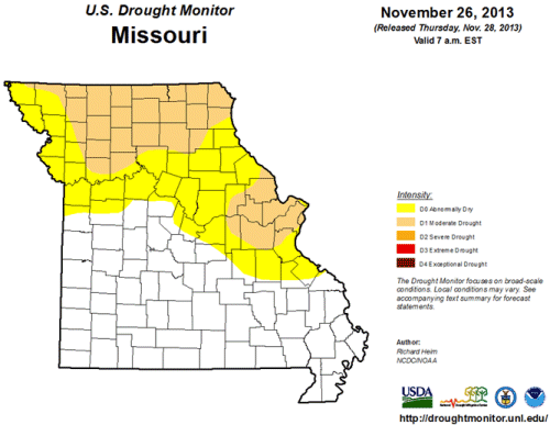
Figure 5
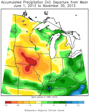
Figure 6
Source: Pat Guinan, 573-882-5908


