
May 2014 Weather and Its Impacts on Missouri
Pat Guinan
State Climatologist
Commercial Agriculture/University of Missouri Extension
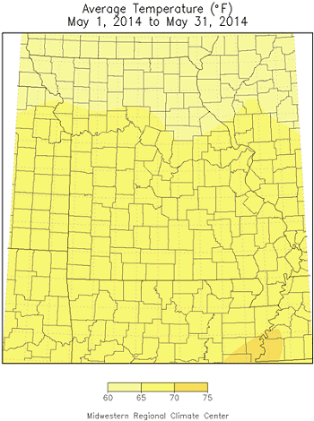
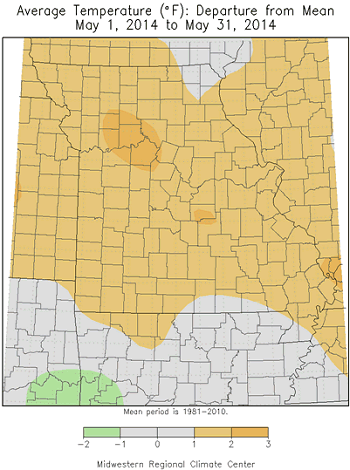
May temperature trends in Missouri were much like April - erratic with alternating periods of warm and cool weather, Figure 1. Preliminary data for the state indicates a warmer than normal month, with an average statewide temperature of 65.8°F, or 1.6°F above normal, Figure 2. The warmer than normal month runs counter to the dominant cool trend that began over a year ago, Figure 3.
Record warmth was reported during the first week of May when high temperatures climbed into the 90s for a couple days. Joplin and Springfield established maximum temperature records on May 4th and 6th. Unusually cold temperatures occurred during the mornings of May 15, 16 and 17 when minimum temperatures dipped into the 30's. Frost damage was reported in some locations, especially low lying areas prone to cold air drainage. Some row crop damage was reported, including injury to sensitive garden and horticulture plants. Kansas City, St. Joseph, Vichy-Rolla, and Joplin established minimum temperature records on one or more of these days. Coldest official temperature for the month was reported at Kirksville Regional Airport (29°F, May 17) and Round Spring, MO (29°F, May 16).
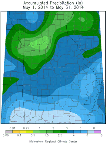
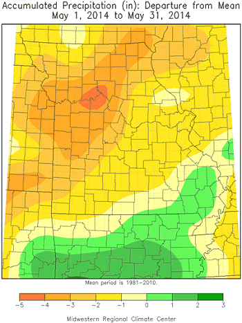
May precipitation was variable, but drier than normal for most of the state. Preliminary data indicate a statewide average total of just over 3 inches, or nearly 2-inches below the long-term average. Heaviest monthly totals were confined to southeastern sections and southern border counties where 4-5 inches were common. Totals ranging from 3-4 inches were typical across extreme northwestern Missouri and east central, south central and southwestern sections. Less than 3-inches were common across northeastern, north central and west central Missouri. According to CoCoRaHS reports, some counties reporting the highest May totals include Barry (6.15"), Crawford (6.55"), Taney (6.58"), Douglas (7.36) and Bollinger (7.51"). Some of the lightest monthly totals were confined to west central Missouri where less than 1-inch was reported in parts of Jackson, Clay, Johnson, Carroll and Linn counties.
Drought and abnormally dry conditions were still impacting all of northern, west central and southwestern Missouri during the last week of May, according to the Drought Monitor map for May 27, 2014, Figure 4. Some long-term precipitation deficits of more than 12-inches have accumulated over the past year, Figure 5, and sub-soil moisture supplies were depleted in the driest areas. Surface water levels were also dropping and it is imperative significant rainfall returns soon, or growing season conditions will rapidly deteriorate as summer approaches.
Jump to:
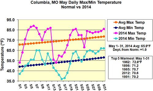
Figure 1.
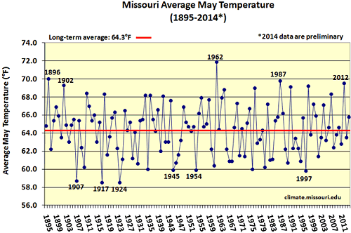
Figure 2.
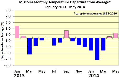
Figure 3.
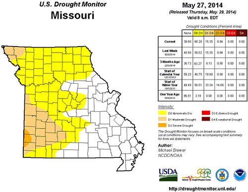
Figure 4.
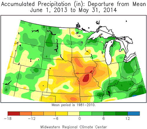
Figure 5.
Source: Pat Guinan, 573-882-5908