
April 2016 Weather and Its Impacts on Missouri
Pat Guinan
State Climatologist
University of Missouri Extension
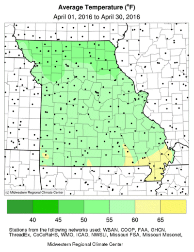
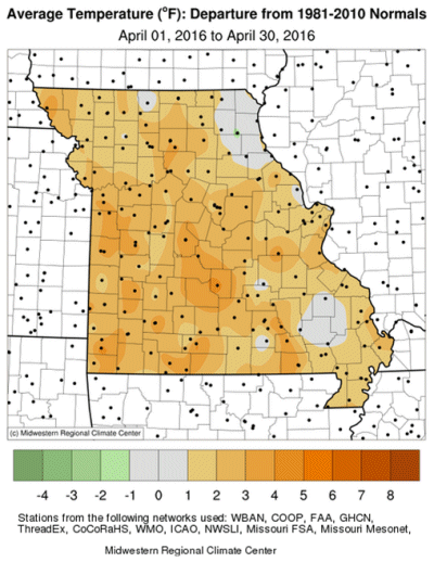
Mild temperatures dominated in April and continued the warmer than average monthly trend that began last September, Figure 1. Preliminary April temperature data indicated a statewide average temperature of 57.0 °F, slightly more than 2 degrees above the long-term average. Other than a cool period during the second week of the month, daily temperatures remained mild for much of the April, Figure 2. There have been only 5 cooler than average Aprils since 1999, Figure 3.
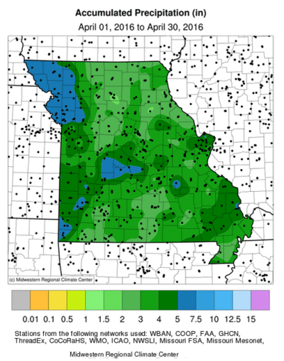
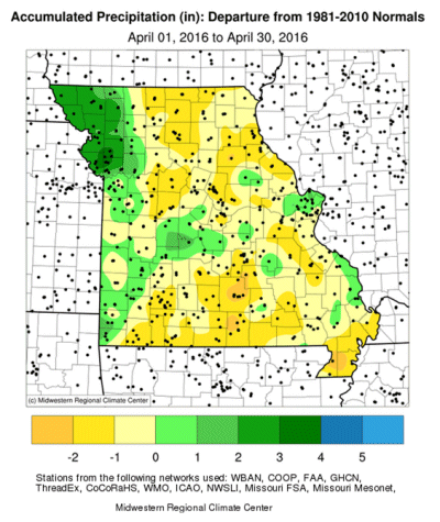
According to preliminary data, April precipitation was slightly below average with an annual statewide total of 3.80 inches, or 0.17 inches below the long-term average. It was the fourth consecutive month with below average precipitation, Figure 4, and second consecutive April with slightly below average precipitation, Figure 5.
Regionally, wetter April conditions were reported across far western Missouri where 4-5 inches were common; several locations between Kansas City and St. Joseph reported 5-7 inches for the month. Driest areas were confined to parts of north central, northeastern, and south central Missouri where less than 2-inches were observed.
The year-to-date precipitation deficit was reflected in the Drought Monitor map for the end of April, with abnormally dry conditions impacting much of the state and pockets of moderate drought over west central and southwestern Missouri, Figure 6. It was the state's driest January thru April period since 2000, Figure 7, and Missouri had some of the highest year-to-date precipitation deficits in the central U.S., Figure 8. A dry start to the first four months of the year provides no clue to the type of weather patterns that set-up during the remainder of spring and summer.
The extreme wet conditions in November and December, in combination with time of year, i.e. cool temperatures, dormant vegetation and minimal evaporation, mitigated potential impacts from four consecutive months of below average precipitation. The mild and generally dry April conditions were welcomed by farmers for planting opportunities. According to the National Agricultural Statistics Service, Missouri led the country in percentage of corn planted (89%) for the week ending May 1st, 42 percentage points ahead of the five year average. Stock water supplies were reported mostly adequate (89%), as well as hay supplies and other roughages (83%) according to the Missouri Agricultural Statistics Service. Nearly 90% of the pastures were in fair to good condition. Topsoil and subsoil moisture supplies were mostly adequate statewide, with the exception of southwestern Missouri where 55% of the crop reporting district reported topsoil moisture supply in short to very short condition and 57% of the district reported subsoil moisture supply in short to very short condition.
Jump to:
- Figure 1
- Figure 2
- Figure 3
- Figure 4
- Figure 5
- Figure 6
- Figure 7
- Figure 8
- Figure 9
- Figure 10
- Figure 11
- Figure 12
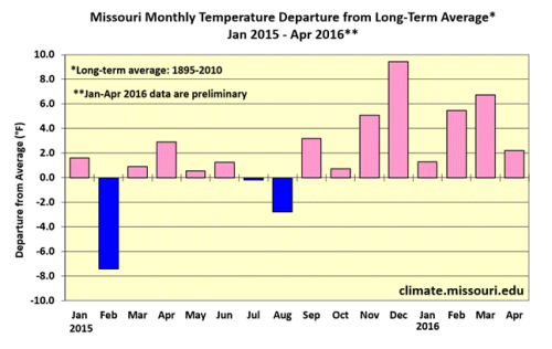
Figure 1.
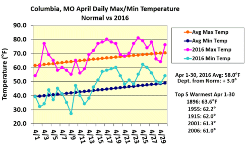
Figure 2.
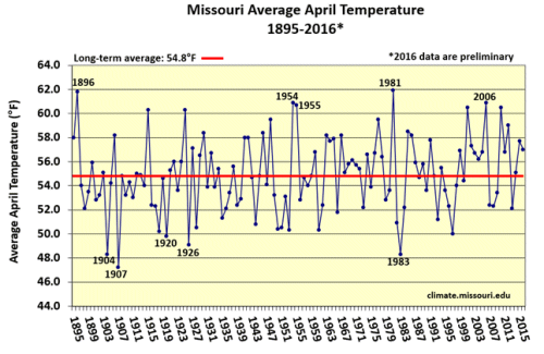
Figure 3.
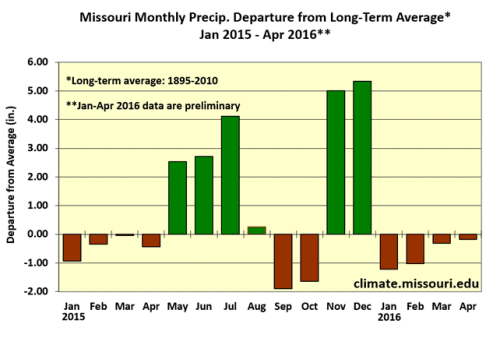
Figure 4.
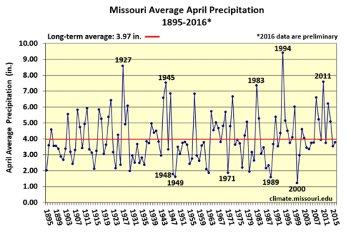
Figure 5.
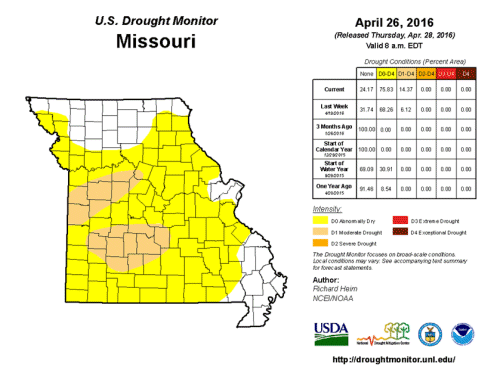
Figure 6.
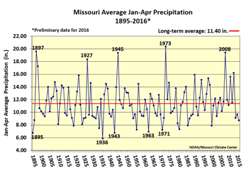
Figure 7.
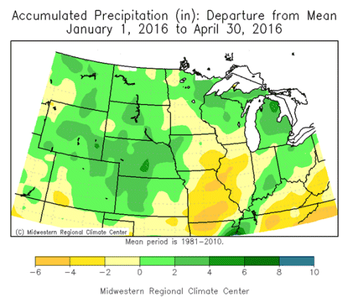
Figure 8.
Source: Pat Guinan, 573-882-5908